
Kitsap County Neighbors by Source
No official source publishes a complete roster of each Kitsap County block. The county map shows tax lots, the Assessor supplies assessment fields, Elections controls voter-data access, and civic groups describe communities. These sources can be joined only with care. A taxpayer can live elsewhere, a mailing address can differ from the site address, and an association contact may represent a group without living beside the searched parcel.
| Official or local source | What it shows about a block | Access path |
|---|---|---|
| Kitsap Parcel Search Map | Tax lots, parcel IDs, site and mail fields, map layers, and linked details | Free interactive map |
| Parcel Details | Taxpayer, account, parcel, site address, and mailing address | Free public search |
| Kitsap voter-data order | Permitted registration fields by district or precinct | Signed affidavit and Elections request |
| Bremerton neighborhood page | Named organizations and community contacts | Public city page |
| County advisory councils | Agendas, minutes, local issues, and council contacts | Public county pages |
The parcel map is the best first view because it keeps the work tied to place. It does not establish a resident list. Record what each field actually says and label broader facts, such as a community bookmark or district, as context.
Map Kitsap County Neighbor Parcels
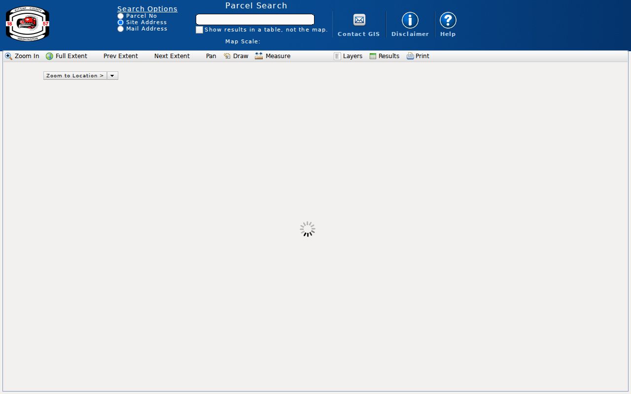
The Kitsap County Parcel Search Map can search by parcel number, site address, mail address, or taxpayer. It also has selection, buffer, layer, measurement, print, and results-table controls. Start with one verified site address. A site address locates the property; a mailing address tells where assessment mail goes. Keep the two fields separate.
The official map capture shows the tool used to place adjacent tax lots in context.
Follow a repeatable small-area process:
- Search the full site address. If it fails, retry with the street name only because one parcel may carry more than one address.
- Select the subject parcel and save its parcel or account number. Note the map date and active layer.
- Use a documented buffer or click only the touching and facing tax lots. Save the distance and each neighboring parcel ID.
- Open the results table, then review site address, mail address, taxpayer, sales history, voting districts, and split or merge links as separate fields.
- Confirm a name through another lawful, time-aligned source before describing a person as one of the current neighbors.
The full named-street chain belongs in the Kitsap County street directory. Keep a neighbor search to the immediate block or stated radius.
Kitsap County Parcel Table View
The map's table-not-map option is a useful insider feature. It turns selected parcels into rows that are easier to compare. The result family can link to tax statements, parcel details, photos or sketches, voting districts, sales history, DCD permits, and detailed tax maps. Splits and merges can explain why a current block does not match an older plat or directory.
- Parcel
- A tax and map unit identified by the county. It is not proof of a surveyed boundary.
- Site address
- The location assigned to the property itself.
- Mailing address
- The address used for assessment mail, which may be elsewhere.
- Buffer
- A measured area drawn around a selected map feature.
- Taxpayer
- The person or entity named for assessment purposes, not automatic proof of title or occupancy.
Save the selected layer and buffer distance with the exported or printed result. County cadastral maps are for tax indexing and public-record reference. A licensed survey, not a GIS line, decides a disputed boundary.
Note: Map bookmarks and tax-lot rows provide geographic context, not official neighborhood membership or a verified list of residents.
Kitsap County Address Gaps
A blank address result can come from a changed road name, a corrected house number, a spelling variant, vacant land, or the county's one-address-per-parcel practice. Kitsap's address-correction work responds to duplicate and out-of-sequence numbers and confusing road names. A notice supplies an effective date, while the change itself does not alter the property's legal status.
Retry by street only, then search by parcel or legal description. Compare the county's address-correction information and preserve both old and new labels. For a current postal form, USPS can confirm the delivery label. Postal city, municipal boundary, county service area, and tribal or community labels may still differ at one location.
The neighbor search should report those labels as the sources display them. Do not silently replace a historic street label or treat a postal city as proof that the block is inside that city's limits. In Kitsap County, this matters around Bremerton, Port Orchard, Poulsbo, Bainbridge Island, Kingston, Suquamish, and many unincorporated communities.
Kitsap County Neighbor Groups
Community organizations add local context that the parcel layer cannot provide. They may publish a meeting calendar, contact address, minutes, project history, or issue list. They are not official resident rolls, and a named officer or contact should not be treated as proof of a home address.
Manette and Union Hill
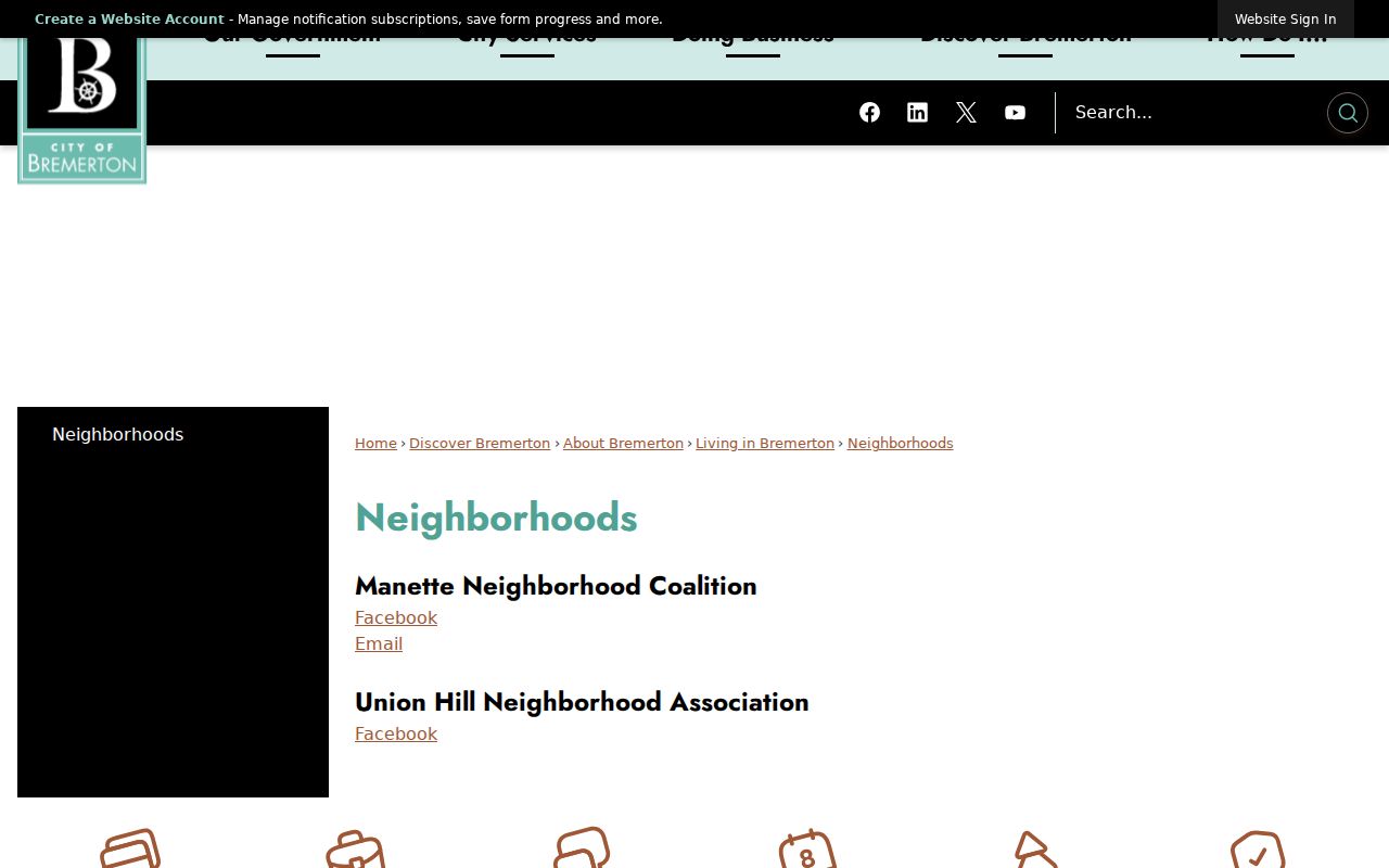
The Bremerton neighborhood page identifies the Manette Neighborhood Coalition and Union Hill Neighborhood Association.
County Advisory Councils
Kitsap County lists councils for Central Kitsap, Kingston, Manchester, and Suquamish, with public meetings and local planning context.
Neighborhood Watch
Bremerton's program provides a Community Resource Specialist route at 360-473-5231 for community safety organizing.
Place-Based Groups
County participation materials name groups in Hansville, Indianola, Illahee, Keyport, Stavis Bay, and other communities as issue contacts.
The captured Bremerton page is a direct route to current city-recognized neighborhood contacts.
For county areas, council agendas and minutes can explain a road, ferry, subarea plan, or public project affecting the block. Keep the organization name and meeting date. Membership and residence remain separate facts.
Kitsap County Neighbor Voter Rules
The GIS voting-district link is a parcel-level district crosswalk, not a list of voters. District lines change, so record the map date. VoteWA is also not a public by-name directory. It requires a registrant's first name, last name, full date of birth, and reCAPTCHA to access a self-service profile.
Kitsap Elections offers a separate voter-data order. A requester can select a voting-record report, registered-voter report, or voters-by-district report and must sign a noncommercial-use affidavit. Public fields can include name, address, political jurisdiction, gender, year of birth, voting record, registration date, and registration number. Phone and email are confidential. Electronic delivery has no fee, while paper copies are priced per page plus postage.
Washington's voter-list rules in RCW 29A.08.720 and RCW 29A.08.740 restrict reproduction and use. The Address Confidentiality Program adds a vital safeguard. Eligible participants use a substitute address, and no one should try to derive or publish the protected actual address.
Kitsap County Block Source Choices
Official records and commercial neighbor tools work differently. Commercial products may blend old addresses, phone data, and people with similar names into one profile. They often hide source dates and correction routes. Kitsap County sources are narrower, but each identifies the custodian, field, map layer, record number, and access rule.
| Question | Official Kitsap route | Commercial category |
|---|---|---|
| Which lots surround an address? | Parcel map with selected layer and buffer | May show an unexplained radius |
| Who is named for assessment? | Parcel Details with taxpayer caveat | May merge owner and occupant claims |
| What group serves the area? | City neighborhood or county council page | May lack a current local source |
| How can an error be checked? | Named county, city, or state custodian | Correction process varies |
Use the narrow source that answers the question. If no result appears, say it was not located in the searched official source on the search date. Then name the fields used, known limits, and the next custodian. A no-result is not proof that a parcel, record, or person does not exist.
Kitsap County Neighbor Privacy Limits
Parcel records name taxpayers and mail destinations, not all adults, children, guests, or other people at a site. Voter information has statutory restrictions. Utility, delivery, health, motor-vehicle, victim, adoption, sealed court, and protected-address data are not open invitations to build a household file. Suppress full birth dates, personal phone or email, minors' details, and any field marked confidential.
Washington's Address Confidentiality Program protects the actual address of eligible people and supplies a substitute address for covered records. Never reverse-geocode that address, compare hidden fields to expose it, or publish a suspected location. A block map can support civic curiosity, local history, a friendly introduction, or awareness of a public project without identifying every household.
Keep a short source log instead of a personal dossier. The log should contain the starting address, parcel identifiers, selected layer, radius, map date, and direct links to the public pages reviewed. Mark an assessment name as a taxpayer field. Mark an association item as community context. If two sources conflict, preserve both labels and send any correction to the office that maintains the record. Do not fill a gap with a guess.
Time matters as much as place. Weekly assessment data, changing district lines, a new address notice, and a current group contact can describe different dates. A screenshot should carry its inspection date, while an older meeting minute should retain its meeting date. This simple practice prevents a past fact from being stated as current and makes later checking much easier.
Lawful use. Research Kitsap County neighbors only for lawful personal purposes. Never use parcel, voter, or group information to stalk, harass, threaten, or expose anyone.